Strengthening Resilience of Communities with Respect to Cyclones in Southern Africa: Case Study Impact of Cyclone Idai on the Buzi, Pungwe and Save River basins
Client
United States Agency for International Development (USAID) / Chemonics
Location
Mozambique and Zimbabwe
Project Duration
January 2020 – November 2020
Background
The purpose of this Project was to carry out an assessment of the impacts of Cyclone Idai on communities in Mozambique and Zimbabwe and to identify lessons, tools, and strategies for the strengthening of communities’ resilience towards cyclones. The two main objectives were to assess the impacts of Cyclone Idai at the community level in Mozambique and Zimbabwe, and to identify lessons and opportunities to strengthen the communities’ resilience against cyclones.
Services Provided
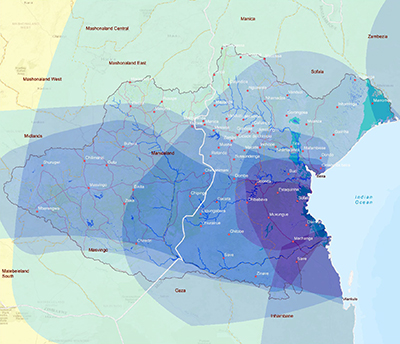
The Project focused on three river basins shared between the two countries, (i.e., the Buzi, Pungwe and Save basins (BuPuSa)), and included the following activities:
1. Assessment of the extent of the impacts of Cyclone Idai in Mozambique and Zimbabwe in terms of areas, the nature of the damage and the number of affected communities and population. This included profiling of the cyclone in terms of its nature and impacts, including the following: mapping of cyclone paths and associated intensities; flood mapping and analysis; damage to public infrastructures (e.g., dams, weirs, bridges, power lines, roads, etc.); damage to household assets (e.g., buildings, fields, livestock grazing land, etc.); affected persons and households (e.g., deaths, injuries, displacement); and income losses (e.g., destroyed crops, animal losses).
2. Desktop study of the impacts of other cyclones (e.g., Cyclones Eline and Dineo) on local communities and adaptations to them. This included livelihood analyses of the affected population and the cyclone’s impact on the livelihood sources: impacts of cyclones and responses/ adaptations worldwide; and impacts of earlier cyclones and responses in southern Africa (e.g., Cyclone Dineo).
3. Desktop assessment of the impacts of and the level of support (national, transboundary and international) offered to the affected population and communities. Methods included interviews with government, national and international relief organisations and where possible site visits.
4. A regional workshop to discuss the results of the impact assessment and mitigation/resilience strategies.
5. Preparation of follow-up community-focused activities/plans to enhance local community preparedness in the face of extreme weather events. For example, selection of two large and two small villages for in-depth analysis in each country, selection of country partner institutions, etc.
To facilitate the project activities noted above, Hatfield provided services in the areas of satellite image acquisition, satellite image analysis, data capture, data curation and quality assessment, geospatial analysis and cartography.