Eelgrass Explorer
Client:
Canadian Space Agency
Location:
Canada
Dates:
February 2025 – Ongoing
Background:
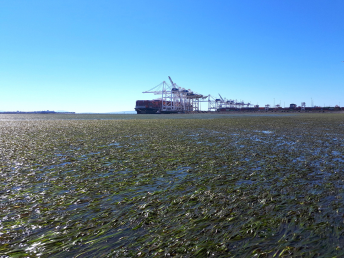
Eelgrass (Zostera marina) beds are an important habitat for a variety of marine species, including several species with considerable importance to Canadian fisheries, such as juvenile Pacific salmon, young Pacific herring, eulachon, clams, scallops, and crabs. In Canada, Fisheries and Oceans Canada (DFO) has designated eelgrass as an Ecologically Significant Species and eelgrass habitats are prioritized for conservation. Despite their importance, eelgrass beds are in decline and continue to be threatened by various anthropogenic and climate stressors that have led to overall loss and fragmentation.
Ensuring healthy eelgrass habitat along coastal British Columbia is especially important given the existing pressures on marine species, particularly Pacific salmon, from habitat loss and degradation, pollution, disease, predation, and climate change. Consistent and up-to-date spatial maps on eelgrass distribution across British Columbia are key to effective management and decision making.
Services Provided:
Hatfield leads the design and development of the Eelgrass Explorer (E2) system for mapping eelgrass in the intertidal areas across the entire British Columbia coast.
E2 is a prototype Cloud-based processing platform that uses time series of multispectral satellite EO data and deep learning AI models to produce province-wide intertidal eelgrass extent maps. The E2 System aims to provide accurate and timely data on eelgrass distribution. Its design enables the automated application of the AI models on new imagery along with a model retraining functionality for updating when new training data is available. The Cloud-based infrastructure uses platform agnostic open-source technology to facilitate portability to other cloud-based platforms, such as Digital Earth Canada.
Eelgrass detection is based on Sentinel-2 (ESA) and SuperDove (Planet) images, with additional data for development from Wyvern (Dragonette). The project includes field work including drone data acquisition and in-situ observations to assist in model development and validation. System outputs will be validated in selected representative sites to provide performance assessments and guide future use. The output eelgrass extent data will be publicly available through collaboration with various external project partners.
The E2 system is developed in partnership with the SPECTRAL Remote Sensing Lab, University of Victoria, and ‘Namgis First Nation. This project is undertaken with the financial support from the Canadian Space Agency’s smartEarth initiative.