AI for Forest Linear Disturbance Detection in Forested Denesųłiné Traditional Territories
Client/Funding Agency:
Ya’thi Néné Lands and Resources (YNLR)/GeoConnections – Natural Resources Canada
Location:
Saskatchewan, Canada
Dates:
April 2025 – Ongoing
Background:
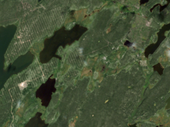
Across the Canadian boreal forest region, habitat fragmentation due to linear disturbances (roads, seismic exploration, pipelines, and energy transmission corridors) is a critical issue for the protection of woodland caribou (Rangifer tarandus), a federally designated threatened species and a valuable indicator of the health of boreal forest ecosystems.
Building upon previous AI-based linear disturbance detection research Hatfield completed in Alberta, the goal of this project is to co-develop a solution for monitoring of woodland caribou habitat condition in Northern Saskatchewan with Ya’thi Néné Lands and Resources (YNLR), with potential for scalability across Canada’s boreal forest region. YNLR is a non-profit organization owned by the seven Athabasca Basin communities of Hatchet Lake Denesułiné First Nation, Black Lake Denesułiné First Nation, Fond du Lac Denesułiné First Nation and the municipalities of Stony Rapids, Uranium City, Wollaston Lake, and Camsell Portage.
Services Provided:
Hatfield and YNLR will collaborate to develop, demonstrate, and validate a standards-based AI-based method to map linear forest disturbances from satellite Earth Observation (EO) data. The outputs are:
- Proof-of-concept pipeline (pre-processing, deep learning model adaptation and application, post processing)
- Demonstration and validation of disturbance detection in the Western Taiga and Athabasca Plains ecoregions of Northern Saskatchewan
- Assessment of transferability in the Québec Boreal Shield ecoregion
The proposed technical solution and geospatial data address an important gap and issue for Indigenous organizations, federal and provincial/territorial governments, and industry. Cumulative landscape disturbance is a major challenge facing Canada’s forests with disturbances such as forest harvesting, oil & gas, mining, renewable energy, and natural events such as wildfires. Impacts of cumulative disturbances are considerable concerns for wildlife habitat integrity and biodiversity. The project aims to bring innovative deep learning technologies with commercial and open EO satellite data in a cloud-based processing environment to design a solution that would address Canadian interests.
This project is undertaken with the financial support of the Government of Canada via the Department of Natural Resources GeoConnections Program.
Photo credit: Copernicus Sentinel data (2022)