Hatfield Consultants

  • About
    • At A Glance
    • Our Leaders
    • Our History
    • Corporate Social Responsibility
    • Quality Management
    • Health & Safety
    • Environmental Policy
    • Indigenous Relations
    • Regions
      • Canada
      • Indonesia
      • Africa
  • Services
    • Water
      • Fish & Fish Habitat
      • Effects Monitoring & Ecotoxicology
      • Hydrology
      • Hydrogeology
      • Marine Ecology
      • Marine & Coastal Infrastructure
      • Regulatory Permitting
    • Land
      • Infrastructure Development
      • Vegetation & Wetlands
      • Forestry
      • Wildlife
      • Regulatory Permitting
    • People
      • Social Science
      • Engagement & Consultation
      • Knowledge Management
      • Human Centered Design
    • Technology
      • GIS & Mapping
      • Remote Sensing
      • Data & Information Management
      • Data Analytics
  • Sectors
    • Marine
    • Forestry
    • Infrastructure
    • International Development
    • Mining & Exploration
    • Oil & Gas
    • Pulp & Paper
    • Clean Energy
  • Projects
  • News
  • Careers
    • Why Work at Hatfield?
    • Current Opportunities
  • Contact

Reduced Emission from Deforestation and Forest Degradation a COP15 priority

You are here: Home / News / Reduced Emission from Deforestation and Forest Degradation a COP15 priority

Reduced Emission from Deforestation and Forest Degradation a COP15 priority

Dec 16, 2009

In line with the priorities of the COP15 climate change summit in Copenhagen, Hatfield Consultants is leading a series of high-profile projects related to how land use and reduced emission from deforestation and forest degradation (REDD) can contribute to a global climate change deal.


Hatfield uses earth observation (satellite and aerial imagery) products and services for compliance monitoring of REDD projects. Since the 1980s, a variety of satellite sensors such as the Landsat TM/ETM+ and SPOT series have been used for forestry applications. Landsat is popular because of its suitability to cost-effectively monitoring large forest areas and because of its archive for determining forest cover change. Earth observation products allow for compliance monitoring of REDD and associated compensation agreements through the following steps:

  • Developing a Baseline to determine the present land cover and carbon stock, and their historical rate of change;
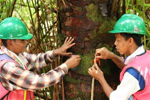
  • Ongoing Monitoring to validate the benefits of the project;
  • Independent audit of the project using an accepted standard; and
  • Sale of the carbon credits directly or through a broker or aggregator.

With over thirty years of relevant experience, Hatfield can support development of carbon projects that meet recognized voluntary carbon standards. Hatfield promotes ‘best practices’ and our products and services exceed the current accepted standards for carbon project validation, and will meet future enhanced standards as they develop.

Earth Observation Services for Forest Carbon Emissions Projects

Hatfield Consultants (Canada) and PT Hatfield Indonesia are implementing a project funded by the European Space Agency called Earth Observation Services for Forest Carbon Emissions Projects (EO-FORCE). EO-FORCE involves the design of integrated remote sensing and forestry products and services for land use and forest carbon projects, and implementation and evaluation of trial services to projects in Indonesia.

For more information, please visit the following page or contact us:

  • Hatfield’s Remote Sensing Services

Dr. Andy Dean, Ph.D
Remote Sensing and GIS Specialist
HATFIELD CONSULTANTS PARTNERSHIP

E-mail: hatfindo@hatfieldgroup.com
Tel.: +62 0251 324 487
Toll-Free: 1 866 926 3261

Reduced Emission from Deforestation and Forest Degradation a COP15 priority

December 16, 2009 by

Interested in joining our innovative team?

Career Opportunities
  • Home
  • About
  • Projects
  • News
  • Careers
  • Contact
  • Agent Orange

Sectors

  • Marine
  • Forestry
  • Infrastructure
  • International Development
  • Mining & Exploration
  • Oil & Gas
  • Pulp & Paper
  • Clean Energy

Services

  • WATER
  • Fish & Fish Habitat
  • Effects Monitoring & Ecotoxicology
  • Hydrology
  • Hydrogeology
  • Marine Ecology
  • Marine & Coastal Infrastructure
  • Regulatory Permitting
  • LAND
  • Infrastructure Development
  • Vegetation & Wetlands
  • Forestry
  • Wildlife
  • Regulatory Permitting
  • PEOPLE
  • Social Science
  • Engagement & Consultation
  • Knowledge Management
  • Human Centered Design
  • TECHNOLOGY
  • GIS & Mapping
  • Remote Sensing
  • Data & Information Management
  • Data Analytics
Copyright © 2021 Hatfield Consultants
  • Terms & Conditions
  • Privacy Policy
  • About
    ▼
    • At A Glance
    • Our Leaders
    • Our History
    • Corporate Social Responsibility
    • Quality Management
    • Health & Safety
    • Environmental Policy
    • Indigenous Relations
    • Regions
      ▼
      • Canada
      • Indonesia
      • Africa
  • Services
    ▼
    • Water
      ▼
      • Fish & Fish Habitat
      • Effects Monitoring & Ecotoxicology
      • Hydrology
      • Hydrogeology
      • Marine Ecology
      • Marine & Coastal Infrastructure
      • Regulatory Permitting
    • Land
      ▼
      • Infrastructure Development
      • Vegetation & Wetlands
      • Forestry
      • Wildlife
      • Regulatory Permitting
    • People
      ▼
      • Social Science
      • Engagement & Consultation
      • Knowledge Management
      • Human Centered Design
    • Technology
      ▼
      • GIS & Mapping
      • Remote Sensing
      • Data & Information Management
      • Data Analytics
  • Sectors
    ▼
    • Marine
    • Forestry
    • Infrastructure
    • International Development
    • Mining & Exploration
    • Oil & Gas
    • Pulp & Paper
    • Clean Energy
  • Projects
  • News
  • Careers
    ▼
    • Why Work at Hatfield?
    • Current Opportunities
  • Contact