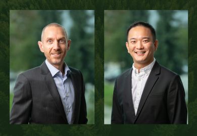
Hatfield announces Andy Dean as new Vice President and Olivier Tsui as Remote Sensing and Geomatics Group Director
Jan 22, 2024
Hatfield is proud to announce the appointment of Andy Dean, MSc, PhD, as a new Vice President and Managing Partner and Olivier Tsui, MSc, as Director of Remote Sensing & Geomatics, effective January 1, 2024.
Andy celebrates 20 years with Hatfield this year, having joined as Geomatics Manager in 2004. Following the completion of his PhD in ecology and remote sensing in the UK, Andy brought a wealth of technical expertise to his new role at Hatfield, building the company’s remote sensing and geomatics capabilities. Over his career with Hatfield, Andy has played several roles at the company, including leading the Remote Sensing and Geomatics Group as Director, Vice President of Hatfield Indonesia, Director of Calgary Operations, Hatfield’s Quality Management Group Lead, and a member of Hatfield’s Senior Partner Group since 2012. Andy’s expertise and experience includes remote sensing, geographical information systems, and information and knowledge management consulting and research in support of environmental assessment, monitoring, and management. Andy’s extensive project work includes projects with the Canadian Space Agency, European Space Agency, World Bank Group, Asian Development Bank, and several United Nations agencies.
Olivier, an Associate Partner since 2021, assumes the role of Director of Remote Sensing and Geomatics. Olivier also celebrates 20 years at Hatfield this year, having a wealth of consulting and research experience in remote sensing and GIS technologies for a range of environmental monitoring applications. He is a seasoned project manager with extensive experience in coordinating and managing projects of various sizes and complexities. Olivier has worked extensively with the private sector in oil & gas, forestry, mining, pulp & paper, and infrastructure. He has considerable experience working with provincial and federal government departments and agencies, including the Canadian Space Agency and European Space Agency, and non-government organizations and international organizations.
Both of these appointments are possible because of Hatfield’s strategy to build corporate and group management capacity to support our sustainable growth. Please join us in welcoming Andy and Olivier to their new roles and congratulating them on their 20-year anniversaries with Hatfield!
About Hatfield’s Remote Sensing & Geomatics Group
Hatfield is a technical leader in the use of remote sensing technology for environmental monitoring and assessment. Building on decades of scientific experience with optical, radar, lidar, and remotely piloted aerial systems data, we apply cutting-edge approaches to acquire, manage, and analyze data to deliver products and strategic insights. We are proud to work with a range of clients including government, private sector, and non-government clients on the use of remote sensing technology for environmental monitoring and management around the world. Recent notable work includes smartWhales, helping to detect endangered North Atlantic right whales using satellite Earth observation data. Read more about our recent projects here.
