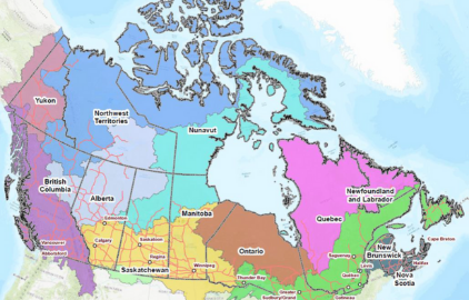
Hatfield supports Natural Resources Canada with the development of Starter Kits for the Canadian Geospatial Data Infrastructure (CGDI) which helps Canadians access geospatial datasets
Aug 11, 2021
Hatfield supports Natural Resources Canada (NRCan) with the research and development of Canadian Geospatial Data Infrastructure (CGDI) analysis ready data kit concept or Starter Kits, a curated set of geospatial datasets and web services. These kits are designed to be easily accessible and usable by new and novice GIS and data analytics users, with special attention to Indigenous Peoples (First Nations, Inuit, Métis) needs. We are pleased to announce that NRCan has released the CGDI Starter Kits and associated technical documents via Open Canada, and the Federal Geospatial Platform, which ensures they are available as a helpful tool to communities and organizations interested in using geospatial datasets.
The CGDI Starter Kits were developed following a user-needs assessment study to thoroughly understand the current requirements of dataset users and how to best add value to their CGDI experience, while saving time and money. While the shift to open government data is very positive, the availability of vast numbers of datasets on the government portal can be a barrier for novice users who struggle to efficiently access these datasets. To overcome this challenge, the CGDI Starter Kits were created with the objective of helping Canadians find, use, and share geospatial data by curating packages of data based on knowledge of what users most commonly require. As a result, these kits add great value for consumers of data, enabling easy access to priority geospatial data.
A set of pilot CGDI Starter Kits are organized into four categories including:
- British Columbia and Northwest Territories (combining federal and provincial/territorial data for a specific area while addressing multiple themes)
- Climate Change and Water Resources (combing data for a particular theme across the whole country)
Each type of starter kit contains data grouped thematically with regards to administrative boundaries, settlements, hydrology, First Nations groups, forestry, and wildlife.
Canadians benefit from using the CGDI in many daily tasks even when they do not realize it. The CGDI is important for national geospatial datasets to be accessible and usable in order to provide the ability to address challenges and take advantage of opportunities in environmental management, climate change and sustainable development. Through fostering collaboration among users in these areas we will see real benefits to the Canadian people, environment, and economy.
For more information on CGDI Start Kits, visit the Open Canada website.
