• About
    • At A Glance
    • Management Team
    • Board of Directors & Ownership
    • Our History
    • Corporate Social Responsibility
    • Quality Management
    • Health & Safety
    • Environmental Policy
    • Indigenous Relationships
    • Regions
      • Canada
      • Indonesia
      • Africa
  • Services
    • Water
      • Aquatic Ecology
      • Effects Monitoring & Ecotoxicology
      • Hydrogeology
      • Hydrology
      • Marine & Coastal Infrastructure
      • Regulatory Permitting (Water)
    • Land
      • Forest Management
      • Infrastructure Development
      • Regulatory Permitting (Land)
      • Terrestrial & Wetland Ecology
    • People
      • Climate Change
      • Community Health & Wellbeing
      • Indigenous Relations & Collaboration
      • Socio-Economics
    • Technology
      • AI & Computer Vision
      • Data Analytics
      • GIS & Mapping
      • Remote Sensing
  • Sectors
    • Development Assistance
    • Forestry
    • Infrastructure
    • Marine
    • Mining & Exploration
    • Oil & Gas
    • Pulp & Paper
    • Renewable Energy
  • Projects
  • News
  • Careers
    • Careers at Hatfield
    • Current Opportunities
    • Why Work at Hatfield?
  • Contact

Witset Groundwater Supply Feasibility Study

You are here: Home / Projects / Witset Groundwater Supply Feasibility Study

Witset Groundwater Supply Feasibility Study

Client:

Witset First Nation

Location:

Witset, Northwest British Columbia

Dates:

May 2025 – December 2025
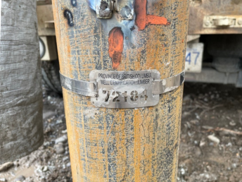
Background:

The community of Witset, located northwest of Smithers, BC, faced several challenges with its existing surface water source, including water quality (turbidity) and insufficient quantity to meet future demand. Alternative surface water sources had been investigated, but their distance from the community presented significant cost and feasibility constraints. Groundwater was identified as a potential option to supplement or replace the existing surface water supply but with past water well installations having limited success.

Services Provided:

Hatfield conducted a desktop investigation of the hydrogeologic setting, which identified the potential presence of a buried bedrock valley aquifer, regionally mapped as the Bulkley Valley channel aquifer. We then carried out a geophysical investigation to map the depth to bedrock at four sites of interest, with the buried valley apparent in two of the refraction seismic sections. Based on accessibility, existing water supply infrastructure, and community water needs, we selected two prospective test well locations.

The results from the test well program indicated that the buried valley/channel gravel deposits beneath Witset are a viable groundwater source, with the potential for these wells to supplement or replace surface water supplies to meet community demands, subject to treatment considerations. We provided recommendations to better understand iron and arsenic concerns through a long-term water quality testing program under pumping conditions, and to develop a potable groundwater supply source, including licensing, should treatment be a viable option.

Witset Groundwater Supply Feasibility Study

Witset Groundwater Supply Feasibility Study

January 20, 2026 by

Find out more about our services from our team of technical experts

Connect With Us
  • Home
  • About
  • Projects
  • News
  • Careers
  • Contact
  • Agent Orange

Sectors

  • Development Assistance
  • Forestry
  • Infrastructure
  • Marine
  • Mining & Exploration
  • Oil & Gas
  • Pulp & Paper
  • Renewable Energy

Services

  • WATER
  • Aquatic Ecology
  • Effects Monitoring & Ecotoxicology
  • Hydrogeology
  • Hydrology
  • Marine & Coastal Infrastructure
  • Regulatory Permitting (Water)
  • LAND
  • Forest Management
  • Infrastructure Development
  • Regulatory Permitting (Land)
  • Terrestrial & Wetland Ecology
  • PEOPLE
  • Climate Change
  • Community Health & Wellbeing
  • Indigenous Relations & Collaboration
  • Socio-Economics
  • TECHNOLOGY
  • AI & Computer Vision
  • Data Analytics
  • GIS & Mapping
  • Remote Sensing
Copyright © Hatfield Consultants
  • Terms & Conditions
  • Privacy Policy
  • About
    ▼
    • At A Glance
    • Management Team
    • Board of Directors & Ownership
    • Our History
    • Corporate Social Responsibility
    • Quality Management
    • Health & Safety
    • Environmental Policy
    • Indigenous Relationships
    • Regions
      ▼
      • Canada
      • Indonesia
      • Africa
  • Services
    ▼
    • Water
      ▼
      • Aquatic Ecology
      • Effects Monitoring & Ecotoxicology
      • Hydrogeology
      • Hydrology
      • Marine & Coastal Infrastructure
      • Regulatory Permitting (Water)
    • Land
      ▼
      • Forest Management
      • Infrastructure Development
      • Regulatory Permitting (Land)
      • Terrestrial & Wetland Ecology
    • People
      ▼
      • Climate Change
      • Community Health & Wellbeing
      • Indigenous Relations & Collaboration
      • Socio-Economics
    • Technology
      ▼
      • AI & Computer Vision
      • Data Analytics
      • GIS & Mapping
      • Remote Sensing
  • Sectors
    ▼
    • Development Assistance
    • Forestry
    • Infrastructure
    • Marine
    • Mining & Exploration
    • Oil & Gas
    • Pulp & Paper
    • Renewable Energy
  • Projects
  • News
  • Careers
    ▼
    • Careers at Hatfield
    • Current Opportunities
    • Why Work at Hatfield?
  • Contact