• About
    • At A Glance
    • Management Team
    • Board of Directors & Ownership
    • Our History
    • Corporate Social Responsibility
    • Quality Management
    • Health & Safety
    • Environmental Policy
    • Indigenous Relationships
    • Regions
      • Canada
      • Indonesia
      • Africa
  • Services
    • Water
      • Aquatic Ecology
      • Effects Monitoring & Ecotoxicology
      • Hydrogeology
      • Hydrology
      • Marine & Coastal Infrastructure
      • Regulatory Permitting (Water)
    • Land
      • Forest Management
      • Infrastructure Development
      • Regulatory Permitting (Land)
      • Terrestrial & Wetland Ecology
    • People
      • Climate Change
      • Community Health & Wellbeing
      • Indigenous Relations & Collaboration
      • Socio-Economics
    • Technology
      • AI & Computer Vision
      • Data Analytics
      • GIS & Mapping
      • Remote Sensing
  • Sectors
    • Development Assistance
    • Forestry
    • Infrastructure
    • Marine
    • Mining & Exploration
    • Oil & Gas
    • Pulp & Paper
    • Renewable Energy
  • Projects
  • News
  • Careers
    • Careers at Hatfield
    • Current Opportunities
    • Why Work at Hatfield?
  • Contact

Evaluating EO Data and Advanced Analytics for Reclamation Certification of Anthropogenic Footprints

You are here: Home / Projects / Evaluating EO Data and Advanced Analytics for Reclamation Certification of Anthropogenic Footprints

Evaluating EO Data and Advanced Analytics for Reclamation Certification of Anthropogenic Footprints

Client:

InnoTech Alberta

Location:

Alberta, Canada

Dates:

June 2023 – June 2025
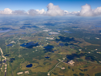
Background:

Reclamation certification for oil and gas well pads in Alberta rely heavily on in-situ detailed site assessments (DSA) under the current regulatory framework. These methods can be resource-intensive, time-consuming, and logistically challenging. The need for timely, consistent, and cost-effective alternatives complementary to in-situ procedures has fueled the exploration of using remote sensing data combined with advanced machine learning to support the reclamation certification process.

This study led by InnoTech Alberta evaluated multi-sensor remote sensing data and machine learning models to complement and enhance DSAs, targeting forested ecosystems in Alberta. The objective was to develop and validate remote sensing-based methods capable of determining reclamation success or identifying areas that require further intervention in alignment with Alberta regulatory requirements. The eventual goal is a method that significantly reduces assessment costs and increases spatial and temporal coverage that complements traditional methods.

Services Provided:

Hatfield developed and evaluated an approach that leverages multi-temporal and multi-sensor datasets: satellite (optical and radar) and airborne LiDAR. The satellite data included Sentinel-1, Sentinel-2, and Landsat imagery, and Very-High-Resolution (VHR) Planet SkySat (sub-meter resolution) imagery, which were used as inputs to analytical and detailed visual assessments. Airborne LiDAR data were used when available, providing additional structural and topographical   data critical for comprehensive well site evaluations.

Using Hatfield’s solution, well pad reclamation success was determined using an integrated analytical framework combining five distinct but complementary inputs: a decision tree (DT) classification model, spectral recovery analysis, baseline temporal comparisons, and visual examination of VHR and LiDAR-derived products. Each method was independently conducted for each well site. The methods evaluate vegetation recovery in terms of spectral characteristics, temporal dynamics, spatial variations, comparability to undisturbed reference areas, and structural and topographic properties. These methods combine to provide effective information for evaluating reclamation status.

Hatfield’s assessment framework offers potential to guide site assessments and remotely determine when sites are ready for DSA reducing potential visits to site not ready for certification. The framework also helps identify sites in need of further intervention activities. The study ultimately demonstrated that remote sensing methods can support regulators and industry, leading to improved and more efficient environmental management.

Evaluating EO Data and Advanced Analytics for Reclamation Certification of Anthropogenic Footprints

Evaluating EO Data and Advanced Analytics for Reclamation Certification of Anthropogenic Footprints

December 19, 2025 by

Find out more about our services from our team of technical experts

Connect With Us
  • Home
  • About
  • Projects
  • News
  • Careers
  • Contact
  • Agent Orange

Sectors

  • Development Assistance
  • Forestry
  • Infrastructure
  • Marine
  • Mining & Exploration
  • Oil & Gas
  • Pulp & Paper
  • Renewable Energy

Services

  • WATER
  • Aquatic Ecology
  • Effects Monitoring & Ecotoxicology
  • Hydrogeology
  • Hydrology
  • Marine & Coastal Infrastructure
  • Regulatory Permitting (Water)
  • LAND
  • Forest Management
  • Infrastructure Development
  • Regulatory Permitting (Land)
  • Terrestrial & Wetland Ecology
  • PEOPLE
  • Climate Change
  • Community Health & Wellbeing
  • Indigenous Relations & Collaboration
  • Socio-Economics
  • TECHNOLOGY
  • AI & Computer Vision
  • Data Analytics
  • GIS & Mapping
  • Remote Sensing
Copyright © Hatfield Consultants
  • Terms & Conditions
  • Privacy Policy
  • About
    â–Ľ
    • At A Glance
    • Management Team
    • Board of Directors & Ownership
    • Our History
    • Corporate Social Responsibility
    • Quality Management
    • Health & Safety
    • Environmental Policy
    • Indigenous Relationships
    • Regions
      â–Ľ
      • Canada
      • Indonesia
      • Africa
  • Services
    â–Ľ
    • Water
      â–Ľ
      • Aquatic Ecology
      • Effects Monitoring & Ecotoxicology
      • Hydrogeology
      • Hydrology
      • Marine & Coastal Infrastructure
      • Regulatory Permitting (Water)
    • Land
      â–Ľ
      • Forest Management
      • Infrastructure Development
      • Regulatory Permitting (Land)
      • Terrestrial & Wetland Ecology
    • People
      â–Ľ
      • Climate Change
      • Community Health & Wellbeing
      • Indigenous Relations & Collaboration
      • Socio-Economics
    • Technology
      â–Ľ
      • AI & Computer Vision
      • Data Analytics
      • GIS & Mapping
      • Remote Sensing
  • Sectors
    â–Ľ
    • Development Assistance
    • Forestry
    • Infrastructure
    • Marine
    • Mining & Exploration
    • Oil & Gas
    • Pulp & Paper
    • Renewable Energy
  • Projects
  • News
  • Careers
    â–Ľ
    • Careers at Hatfield
    • Current Opportunities
    • Why Work at Hatfield?
  • Contact