• About
    • At A Glance
    • Management Team
    • Board of Directors & Ownership
    • Our History
    • Corporate Social Responsibility
    • Quality Management
    • Health & Safety
    • Environmental Policy
    • Indigenous Relationships
    • Regions
      • Canada
      • Indonesia
      • Africa
  • Services
    • Water
      • Effects Monitoring & Ecotoxicology
      • Fish & Fish Habitat
      • Hydrogeology
      • Hydrology
      • Marine Ecology
      • Marine & Coastal Infrastructure
      • Regulatory Permitting
    • Land
      • Forest Management
      • Infrastructure Development
      • Regulatory Permitting
      • Terrestrial Ecology
    • People
      • Climate Change
      • Community Health & Wellbeing
      • Indigenous Relations
      • Socio-Economics
    • Technology
      • AI & Computer Vision
      • Data Analytics
      • GIS & Mapping
      • Remote Sensing
  • Sectors
    • Forestry
    • Infrastructure
    • International Development
    • Marine
    • Mining & Exploration
    • Oil & Gas
    • Pulp & Paper
    • Renewable Energy
  • Projects
  • News
  • Careers
    • Careers at Hatfield
    • Current Opportunities
    • Why Work at Hatfield?
  • Contact

Hatfield receives grant from Microsoft’s AI for Earth program, accelerating our work in caribou habitat disturbance mapping in northern Canada

You are here: Home / News / Hatfield receives grant from Microsoft’s AI for Earth program, accelerating our work in caribou habitat disturbance mapping in northern Canada

Hatfield receives grant from Microsoft’s AI for Earth program, accelerating our work in caribou habitat disturbance mapping in northern Canada

Apr 08, 2021

A grant from Microsoft’s AI for Earth program will support Hatfield’s work on boreal caribou, whose populations are in decline in the boreal forest regions of Canada due to habitat fragmentation. With the resources and support from AI for Earth, Hatfield will advance research using satellite Earth observation data and deep learning methods to identify and classify linear habitat disturbances. With this Earth observation data captured across millions of hectares of the boreal caribou ranges, we will develop automated methods to map caribou habitat, both frequently and affordably, to support the decision-making surrounding and implementation of new caribou conservation efforts.

As a member of the Microsoft AI for Earth program, Hatfield joins a cohort of more than 600 organizations in over 85 different countries supported by Microsoft to make a positive impact on the planet through innovative work, while transforming the way the world addresses environmental challenges. Our work relies on access to cloud computing technologies in order to map up to one billion hectares in Canada for linear disturbances, and achieve our overarching goal of supporting boreal caribou conservation. We hope this research will be used in the future as monitoring and assessment solutions by governments, First Nations, industry organizations and NGOs.

AI for Earth is a $50 million, 5-year program by Microsoft providing chosen organizations with access to AI tools and resources, with a particular focus in the areas of water, biodiversity, climate change, and agriculture. As a member of AI for Earth and Microsoft’s Partner network, Hatfield’s team of data scientists and software engineers are focused on helping our clients to embrace cloud native environmental data analytics.

Learn more about Microsoft’s AI for Earth program, or read more about our caribou habitat disturbance mapping here.
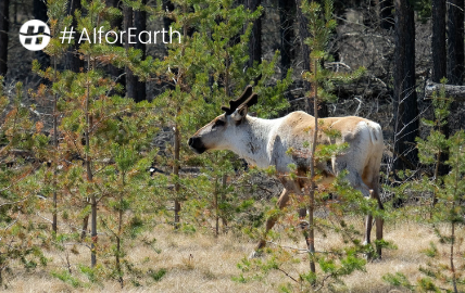
Boreal Caribou Northern Canada

Hatfield receives grant from Microsoft’s AI for Earth program, accelerating our work in caribou habitat disturbance mapping in northern Canada

April 8, 2021 by

Interested in joining our innovative team?

Career Opportunities
  • Home
  • About
  • Projects
  • News
  • Careers
  • Contact
  • Agent Orange

Sectors

  • Forestry
  • Infrastructure
  • International Development
  • Marine
  • Mining & Exploration
  • Oil & Gas
  • Pulp & Paper
  • Renewable Energy

Services

  • WATER
  • Effects Monitoring & Ecotoxicology
  • Fish & Fish Habitat
  • Hydrogeology
  • Hydrology
  • Marine Ecology
  • Marine & Coastal Infrastructure
  • Regulatory Permitting
  • LAND
  • Forest Management
  • Infrastructure Development
  • Regulatory Permitting
  • Terrestrial Ecology
  • PEOPLE
  • Climate Change
  • Community Health & Wellbeing
  • Indigenous Relations
  • Socio-Economics
  • TECHNOLOGY
  • AI and Computer Vision
  • Data Analytics
  • GIS & Mapping
  • Remote Sensing
Copyright © Hatfield Consultants
  • Terms & Conditions
  • Privacy Policy
  • About
    ▼
    • At A Glance
    • Management Team
    • Board of Directors & Ownership
    • Our History
    • Corporate Social Responsibility
    • Quality Management
    • Health & Safety
    • Environmental Policy
    • Indigenous Relationships
    • Regions
      ▼
      • Canada
      • Indonesia
      • Africa
  • Services
    ▼
    • Water
      ▼
      • Effects Monitoring & Ecotoxicology
      • Fish & Fish Habitat
      • Hydrogeology
      • Hydrology
      • Marine Ecology
      • Marine & Coastal Infrastructure
      • Regulatory Permitting
    • Land
      ▼
      • Forest Management
      • Infrastructure Development
      • Regulatory Permitting
      • Terrestrial Ecology
    • People
      ▼
      • Climate Change
      • Community Health & Wellbeing
      • Indigenous Relations
      • Socio-Economics
    • Technology
      ▼
      • AI & Computer Vision
      • Data Analytics
      • GIS & Mapping
      • Remote Sensing
  • Sectors
    ▼
    • Forestry
    • Infrastructure
    • International Development
    • Marine
    • Mining & Exploration
    • Oil & Gas
    • Pulp & Paper
    • Renewable Energy
  • Projects
  • News
  • Careers
    ▼
    • Careers at Hatfield
    • Current Opportunities
    • Why Work at Hatfield?
  • Contact