• About
    • At A Glance
    • Management Team
    • Board of Directors & Ownership
    • Our History
    • Corporate Social Responsibility
    • Quality Management
    • Health & Safety
    • Environmental Policy
    • Indigenous Relationships
    • Regions
      • Canada
      • Indonesia
      • Africa
  • Services
    • Water
      • Effects Monitoring & Ecotoxicology
      • Fish & Fish Habitat
      • Hydrogeology
      • Hydrology
      • Marine Ecology
      • Marine & Coastal Infrastructure
      • Regulatory Permitting
    • Land
      • Forest Management
      • Infrastructure Development
      • Regulatory Permitting
      • Terrestrial Ecology
    • People
      • Climate Change
      • Community Health & Wellbeing
      • Indigenous Relations
      • Socio-Economics
    • Technology
      • AI & Computer Vision
      • Data Analytics
      • GIS & Mapping
      • Remote Sensing
  • Sectors
    • Forestry
    • Infrastructure
    • International Development
    • Marine
    • Mining & Exploration
    • Oil & Gas
    • Pulp & Paper
    • Renewable Energy
  • Projects
  • News
  • Careers
    • Careers at Hatfield
    • Current Opportunities
    • Why Work at Hatfield?
  • Contact

GIS & Mapping

Using geospatial technologies to advance environmental and social sciences.

You are here: Home / Services / GIS & Mapping

GIS & Mapping

February 5, 2020 by

Hatfield provides state-of-the-art geospatial services, tools, and strategic advice to enhance environmental and socio-economic data collection, management, analysis, visualization, and sharing. With expertise in GIS, remote sensing, spatial data management, and information technology, our specialists help organizations across sectors to benefit from geospatial technologies.

Working closely with our clients, we provide services in a range of areas:

  • Technological expertise: GIS, remote sensing, geospatial data management, and information technology.
  • Requirements assessment, design, and strategy: user needs assessment, business process analysis, system design, and strategic consulting.
  • Technology development and implementation: mobile data collection, web-mapping, digital cartography, and interactive maps.
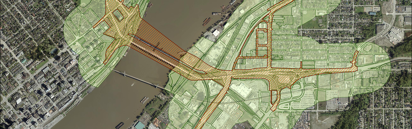
  • Geospatial data analysis: applying our expertise for constraints mapping, environmentally sensitive areas, environmental assessment, watershed analysis, riparian assessment, wildlife and biodiversity assessment, regional planning, and strategic environmental studies. Learn about our data analytics services.

Our Experience

  • Transport Canada certified remotely piloted aircraft and pilots supporting environmental assessment and monitoring.
  • Mobile data collection and web map updates to support the management of major projects
  • User needs assessment and capacity building materials for the Canadian Geospatial Data Infrastructure.

Why Hatfield?

At Hatfield, we work with a range of clients including government, private sector, and non-government clients. Leaning on over 30 years of experience, our GIS & Mapping Team uses geospatial technology to address environmental and socio-economic issues around the world. From local, project-specific needs, to national and international initiatives, Hatfield works with clients and stakeholders to provide solutions for achieving sustainability in the economy, society, and environment.

Water Services

  • WATER
  • Effects Monitoring & Ecotoxicology
  • Fish & Fish Habitat
  • Hydrogeology
  • Hydrology
  • Marine Ecology
  • Marine & Coastal Infrastructure
  • Regulatory Permitting

Land Services

  • LAND
  • Forest Management
  • Infrastructure Development
  • Regulatory Permitting
  • Terrestrial Ecology

People Services

  • PEOPLE
  • Climate Change
  • Community Health & Wellbeing
  • Indigenous Relations
  • Socio-Economics
  • TECHNOLOGY
  • AI and Computer Vision
  • Data Analytics
  • GIS & Mapping
  • Remote Sensing

Find out more about our services from our team of technical experts

Connect With Us

GIS & Mapping Projects

National Survey of Aerial Bomb and Cluster Munitions
2024 - ongoing
smartHarbour – Monitoring Eelgrass, Terrestrial Vegetation, Wetlands, and Shoreline Erosion
2023 - ongoing
Alberta Environment and Protected Areas – Base Hydrography Updates
2020 - ongoing
All Projects

GIS & Mapping Newsfeed

Hatfield supports PEOPLE-ECCO project: Enhancing Ecosystems Conservation through Earth Observation Solutions, Capacity Development and Co-design
January 6th, 2025
Hatfield supports PEOPLE-ECCO project: Enhancing Ecosystems Conservation through Earth Observation Solutions, Capacity Development and Co-design
Hatfield is proud to take part in PEOPLE-ECCO, a two-year project funded by...
Hatfield announces Andy Dean as new Vice President and Olivier Tsui as Remote Sensing and Geomatics Group Director
January 22nd, 2024
Hatfield announces Andy Dean as new Vice President and Olivier Tsui as Remote Sensing and Geomatics Group Director
Hatfield is proud to announce the appointment of Andy Dean, MSc, PhD, as...
Hatfield announces first release of innovative forest fuels mapping solution
October 3rd, 2023
Hatfield announces first release of innovative forest fuels mapping solution
Hatfield is proud to announce the release of arboSense Fuels, a solution designed...
All News

Interested in joining our talented team?

Current Opportunities
  • Home
  • About
  • Projects
  • News
  • Careers
  • Contact
  • Agent Orange

Sectors

  • Forestry
  • Infrastructure
  • International Development
  • Marine
  • Mining & Exploration
  • Oil & Gas
  • Pulp & Paper
  • Renewable Energy

Services

  • WATER
  • Effects Monitoring & Ecotoxicology
  • Fish & Fish Habitat
  • Hydrogeology
  • Hydrology
  • Marine Ecology
  • Marine & Coastal Infrastructure
  • Regulatory Permitting
  • LAND
  • Forest Management
  • Infrastructure Development
  • Regulatory Permitting
  • Terrestrial Ecology
  • PEOPLE
  • Climate Change
  • Community Health & Wellbeing
  • Indigenous Relations
  • Socio-Economics
  • TECHNOLOGY
  • AI and Computer Vision
  • Data Analytics
  • GIS & Mapping
  • Remote Sensing
Copyright © Hatfield Consultants
  • Terms & Conditions
  • Privacy Policy
  • About
    ▼
    • At A Glance
    • Management Team
    • Board of Directors & Ownership
    • Our History
    • Corporate Social Responsibility
    • Quality Management
    • Health & Safety
    • Environmental Policy
    • Indigenous Relationships
    • Regions
      ▼
      • Canada
      • Indonesia
      • Africa
  • Services
    ▼
    • Water
      ▼
      • Effects Monitoring & Ecotoxicology
      • Fish & Fish Habitat
      • Hydrogeology
      • Hydrology
      • Marine Ecology
      • Marine & Coastal Infrastructure
      • Regulatory Permitting
    • Land
      ▼
      • Forest Management
      • Infrastructure Development
      • Regulatory Permitting
      • Terrestrial Ecology
    • People
      ▼
      • Climate Change
      • Community Health & Wellbeing
      • Indigenous Relations
      • Socio-Economics
    • Technology
      ▼
      • AI & Computer Vision
      • Data Analytics
      • GIS & Mapping
      • Remote Sensing
  • Sectors
    ▼
    • Forestry
    • Infrastructure
    • International Development
    • Marine
    • Mining & Exploration
    • Oil & Gas
    • Pulp & Paper
    • Renewable Energy
  • Projects
  • News
  • Careers
    ▼
    • Careers at Hatfield
    • Current Opportunities
    • Why Work at Hatfield?
  • Contact